Anahuac Hangar
Chambers County Airport (Anahuac) is about 1 mile east of Anahuac, TX
- Meetings are at 11:00 am on the 3rd Saturday of each month.
- There may be information about our next meeting in our Facebook Group.
- If you are flying to the meeting, click here for airfield information
- If you are driving to the meeting, Chambers County Airport is about
50 miles (1 hour) east of downtown Houston. See below for detailed
directions for driving or flying in.

| If you’re flying in……
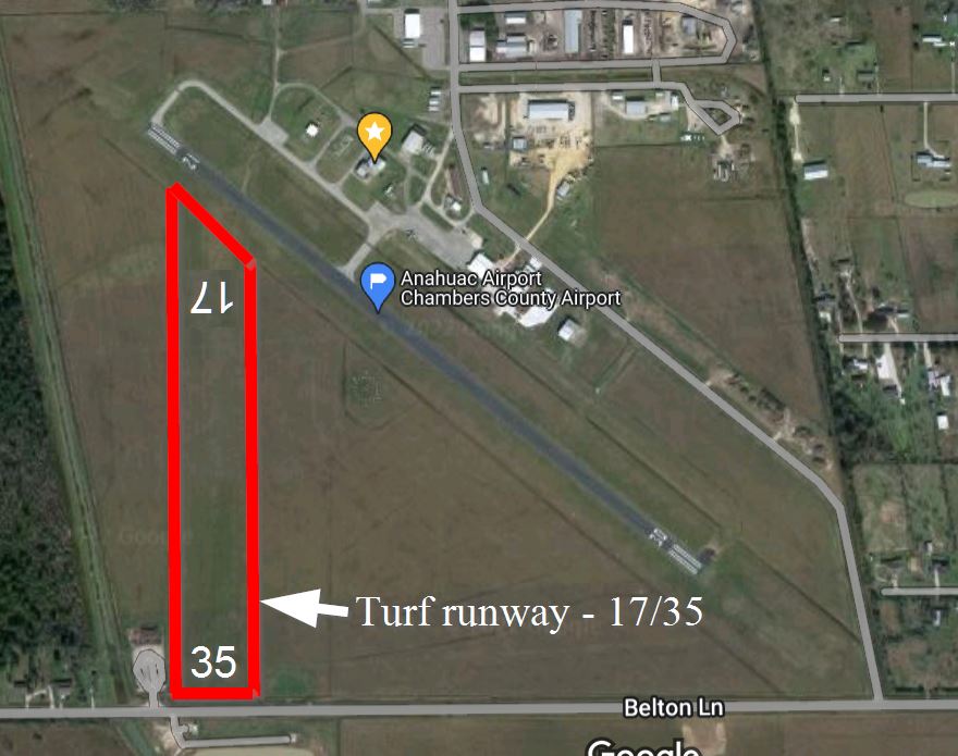
The sectional (opens new tab/window) shows the official airport name is “Chambers County” (T00), but many pilots use “Anahuac traffic” on the CTAF because there is another Chambers County airport on the same frequency (yeah, I know… talk to the FAA about that!). The elevation is 21 feet, CTAF/Unicom freq is 122.9 (a very common band in these parts, so it can be busy). Runway 12 is left-handed traffic, while runway 30 is right-handed. Expect a cross-wind. Not shown on the sectional (but is in the AF/D) is a turf runway, 17/35 (17 is left, 35 is a right pattern), 1900 x 300 ft … it’s very wide but not very long (long enough for a gyro!), and if it’s rained recently then it should be avoided. When dry, though, many aircraft use it and it’s in good shape and is kept mowed. Often it’s a good option because the wind is usually from the SE. Click here for a Google Maps link. |
| If you’re driving in…..
Travel I-10 East from downtown Houston for about 42 miles, get off at exit 810, travel south on FM563 for 6 miles, and turn left on SR-61, then in half-a-mile, turn right into the airport.
Click here for Google Maps link. |


You must be logged in to post a comment.